Coast to Coast Guided Explorer - 17 Days
Operated by UTracks

Coast to Coast Guided Explorer - 17 Days

From
CAD 6,490
Duration
17 days
Countries
United Kingdom
Activity
moderate
Rating
4.8 · 52 reviewsvia UTracks

The adventure

Join a small international group of hikers on Wainwrights Coast to Coast walk. 17-Day guided holiday hiking through quintessential English countryside, qualified leader & some of the best accommodation.

At a glance

Duration
17 days
Route
Countries
United Kingdom
Activity level
moderate
Style
Beach & Islands, Trekking & Hiking
Group size
Ask
Flights
Not included
Solo travellers
Ask an agent

Day by day

Ruins of Hardknott Fort with a mountainous backdrop in England's Lake District.
Your journey through

United Kingdom

Day 1Day 1: Arrive St BeesMake your own way to the starting point of the Coast to Coast walk in St Bees. It's located on the edge of the Irish Sea with views across to the Isle of Man (where we offer a walk as well). If you have time, visit the Abbey church, which has features on the local history and has a display on a mummified knight that was discovered in a lead coffin from the graveyard. If you have an extra night here, you can walk the coastal path or quiet inland roads to the attractive town of Whitehaven with its marina and great museum. It is famous in the annals of the US navy as the site of an elaborate raid on the British mainland by one John Paul Jones during the American War of Independence. This evening you will meet your fellow walkers and guide for a trip briefing.
Make your own way to the starting point of the Coast to Coast walk in St Bees. It's located on the edge of the Irish Sea with views across to the Isle of Man (where we offer a walk as well). If you have time, visit the Abbey church, which has features on the local history and has a display on a mummified knight that was discovered in a lead coffin from the graveyard. If you have an extra night here, you can walk the coastal path or quiet inland roads to the attractive town of Whitehaven with its marina and great museum. It is famous in the annals of the US navy as the site of an elaborate raid on the British mainland by one John Paul Jones during the American War of Independence. This evening you will meet your fellow walkers and guide for a trip briefing.
Day 2Day 2: St Bees to Ennerdale Bridge 23.5 km/14.5 miles, 6 hToday is our first day walking the Coast to Coast! We start with a climb from the beach taking a footpath along red sandstone coastal cliffs of St Bees Head. It has England’s only breeding colony of Black Guillemots (until July). We then move inland over hilly ground to the edge of the Lake District National Park. Dent Hill is the first real fell that we encounter and will give you some indication as to whether you are fit enough for the following days! The path descends to Nannycatch Gate and Beck. It is a delightful stroll which brings us to the final descent to leafy Ennerdale Bridge. The day’s total ascent 780m / descent 665m.
Today is our first day walking the Coast to Coast! We start with a climb from the beach taking a footpath along red sandstone coastal cliffs of St Bees Head. It has England’s only breeding colony of Black Guillemots (until July). We then move inland over hilly ground to the edge of the Lake District National Park. Dent Hill is the first real fell that we encounter and will give you some indication as to whether you are fit enough for the following days! The path descends to Nannycatch Gate and Beck. It is a delightful stroll which brings us to the final descent to leafy Ennerdale Bridge. The day’s total ascent 780m / descent 665m.
Day 3Day 3: Ennerdale Bridge to Borrowdale 26.5 km/16.5 miles, 7 hWalk on a quiet and scenic footpath along the shore of Ennerdale Water, with a bit of an easy scramble under Angler’s Crag at Robin Hood’s Seat. A long walk on a forest track then continues to Black Sail Hut, which is the smallest youth hostel and originally a shepherd’s hut. A steep climb follows up the Lowther Beck before traversing some of the Lakeland fells, perhaps with views down to Buttermere. Finally you reach the ‘drum house’, which marks the descent path to the Honister Slate Mine workings & cafe and Borrowdale. This is perhaps the most delightful valley in the Lakes with its crags and broadleaved trees. Borrowdale is a delightful ensemble of hamlets: Seatoller (Close to the wettest place in England), Longthwaite, Rosthwaite and Stonethwaite. Delightful riverside paths connect these places and their pubs together - if you have sufficient energy left for the evening. You might be interested to know that ‘thwaite’ is old Norse for paddock. The day’s total ascent 765m / descent 785m.
Walk on a quiet and scenic footpath along the shore of Ennerdale Water, with a bit of an easy scramble under Angler’s Crag at Robin Hood’s Seat. A long walk on a forest track then continues to Black Sail Hut, which is the smallest youth hostel and originally a shepherd’s hut. A steep climb follows up the Lowther Beck before traversing some of the Lakeland fells, perhaps with views down to Buttermere. Finally you reach the ‘drum house’, which marks the descent path to the Honister Slate Mine workings & cafe and Borrowdale. This is perhaps the most delightful valley in the Lakes with its crags and broadleaved trees. Borrowdale is a delightful ensemble of hamlets: Seatoller (Close to the wettest place in England), Longthwaite, Rosthwaite and Stonethwaite. Delightful riverside paths connect these places and their pubs together - if you have sufficient energy left for the evening. You might be interested to know that ‘thwaite’ is old Norse for paddock. The day’s total ascent 765m / descent 785m.
Day 4Day 4: Borrowdale to Grasmere 13.5 km/8.5 miles, 5-6 h via Helm CragEnjoy classic Lakeland scenery on the traverse over Greenup Edge to Easedale and Grasmere. Its a stiff 500m climb up to the edge via Lining Crag where you may get great views back down into Borrowdale. The once boggy trail over the pass has been improved with the laying down of hundreds of Flagstones. After the pass the trail becomes rough and descends steeply into the flower meadows on the ouskirts of Grasmere. Grasmere is one of Lakeland’s most celebrated villages and hopefully there is time either this afternoon or tomorrow morning to visit the poet Wordsworth's home at Dove Cottage and drop into the famous Ginger bread shop! The day’s total ascent 750m / descent 760m.
Enjoy classic Lakeland scenery on the traverse over Greenup Edge to Easedale and Grasmere. Its a stiff 500m climb up to the edge via Lining Crag where you may get great views back down into Borrowdale. The once boggy trail over the pass has been improved with the laying down of hundreds of Flagstones. After the pass the trail becomes rough and descends steeply into the flower meadows on the ouskirts of Grasmere. Grasmere is one of Lakeland’s most celebrated villages and hopefully there is time either this afternoon or tomorrow morning to visit the poet Wordsworth's home at Dove Cottage and drop into the famous Ginger bread shop! The day’s total ascent 750m / descent 760m.
Day 5Day 5: Grasmere to Glenridding 12 km/7.5 miles, 5.5 h standard routeA great walk over Grisedale Pass (609m/2000ft) and around the small mountain lake of Grisedale Tarn to Patterdale. In good weather and if our group is reasonably strong, we recommend that we take the detour route up St Sunday Crag. It will give some exceptional views down across Ullswater on the descend to Patterdale, possibly the most breathtaking of the trip. The day’s total ascent: 900m / descent 805m (via the optional route over St Sunday Crag, less if we avoid this). *Add 1½ hours for the detour of St Sunday Crag.
A great walk over Grisedale Pass (609m/2000ft) and around the small mountain lake of Grisedale Tarn to Patterdale. In good weather and if our group is reasonably strong, we recommend that we take the detour route up St Sunday Crag. It will give some exceptional views down across Ullswater on the descend to Patterdale, possibly the most breathtaking of the trip. The day’s total ascent: 900m / descent 805m (via the optional route over St Sunday Crag, less if we avoid this). *Add 1½ hours for the detour of St Sunday Crag.
Day 6Day 6: Glenridding to Shap 26 km/16 miles, 7-9 hAfter completing today's walk, some would say this was the most difficult stage on the Coast to Coast walk. The day starts with a steep climb up past pretty Angle Tarn. We'll then hike up and onwards to a critical cairn where we turn off the route to High Street. It will take us up and over Kidsty Pike (780m / 2560ft), the highest point on the Coast to Coast, and then descend steeply to walk along Haweswater. This is a huge body of water that was conceived in 1929 to supply Manchester with drinking water, drowning a couple of villages in the process. We then undulate through fields to Shap Abbey, the most easterly point of the Lake District National Park. This was the last abbey to be founded in England (1199) and the last to be destroyed (1540). It nevertheless is a pretty place to take a break with some new interpretation signs. After this, we continue into Shap, the old granite mining town with several pubs and shops. The village offers an interesting insight to the history of the area. The day’s total ascent 1174m / descent 1009m.
After completing today's walk, some would say this was the most difficult stage on the Coast to Coast walk. The day starts with a steep climb up past pretty Angle Tarn. We'll then hike up and onwards to a critical cairn where we turn off the route to High Street. It will take us up and over Kidsty Pike (780m / 2560ft), the highest point on the Coast to Coast, and then descend steeply to walk along Haweswater. This is a huge body of water that was conceived in 1929 to supply Manchester with drinking water, drowning a couple of villages in the process. We then undulate through fields to Shap Abbey, the most easterly point of the Lake District National Park. This was the last abbey to be founded in England (1199) and the last to be destroyed (1540). It nevertheless is a pretty place to take a break with some new interpretation signs. After this, we continue into Shap, the old granite mining town with several pubs and shops. The village offers an interesting insight to the history of the area. The day’s total ascent 1174m / descent 1009m.
Day 7Day 7: Shap to Kirkby Stephen 33 km/20.5 miles, 8 hThere follows a hilly section across Limestone Moors with limestone pavements in places strewn with ‘erratic’ boulders moved there by glaciers. Finally we drop into the gentler climes around Orton. From here, a diversion of about a mile can be made to this quaint picturesque village that is home to Kennedy’s Chocolate Factory shop to lead you into temptation. Walking now between Cumbria and the Yorkshire Dales, there is a lot of attractive farmland to cross with a section of moors around Sunbiggin Tarn - an important site for birds. A steep descent to the Scandal Beck at Smardale Bridge makes for a nice afternoon break stop. Then ascend over Smardale Fell for the pretty descent into Kirkby Stephen's attractive market town. Its St. Hedda’s Church contains the 8th Century Loki stone relating to Norse Mythology. The day’s total ascent 808m / descent 950m.
There follows a hilly section across Limestone Moors with limestone pavements in places strewn with ‘erratic’ boulders moved there by glaciers. Finally we drop into the gentler climes around Orton. From here, a diversion of about a mile can be made to this quaint picturesque village that is home to Kennedy’s Chocolate Factory shop to lead you into temptation. Walking now between Cumbria and the Yorkshire Dales, there is a lot of attractive farmland to cross with a section of moors around Sunbiggin Tarn - an important site for birds. A steep descent to the Scandal Beck at Smardale Bridge makes for a nice afternoon break stop. Then ascend over Smardale Fell for the pretty descent into Kirkby Stephen's attractive market town. Its St. Hedda’s Church contains the 8th Century Loki stone relating to Norse Mythology. The day’s total ascent 808m / descent 950m.
Day 8Day 8: Kirkby Stephen to Keld 24 km/14.5 miles, 6 hClimb out of town to the cairns of Nine Standards Rigg (661m / 2170 feet) with its array of obelisks. This is an ancient, possibly, boundary feature that no one has any real knowledge of. It marks the Watershed of England. Next you cross squelchy moors down to Keld in Swaledale. The trail from the Nine Standards, once the most notorious of the Coast to Coast, has been much improved once again with the placement of hundreds of flagstones. Passing the farm at Ravenseat, where they breed prime rams, the moors then become increasingly gentler as you walk into Keld with its many waterfalls and old stone barns. /// The day’s total ascent 780m / descent 575m. | . The day’s total ascent 780m / descent 575m.
Climb out of town to the cairns of Nine Standards Rigg (661m / 2170 feet) with its array of obelisks. This is an ancient, possibly, boundary feature that no one has any real knowledge of. It marks the Watershed of England. Next you cross squelchy moors down to Keld in Swaledale. The trail from the Nine Standards, once the most notorious of the Coast to Coast, has been much improved once again with the placement of hundreds of flagstones. Passing the farm at Ravenseat, where they breed prime rams, the moors then become increasingly gentler as you walk into Keld with its many waterfalls and old stone barns. /// The day’s total ascent 780m / descent 575m. | . The day’s total ascent 780m / descent 575m.
Day 9Day 9: Keld to Reeth 20 km/12.5 miles, 5 h or 18.5 km/11.5 miles, 5 hThere are two options today. >> The first is the slightly longer & higher alternative over wild moorland with long-abandoned lead mines, a magnet for the industrial archaeologist. >> The second option is the pretty route via Swaledale, which is a lovely option if we have unfavourable weather or we just prefer a lower level walk. There is a really nice pub in Gunnerside on this second route. Our day finishes in Reeth an attractive green village which flourished at the height of the mining age and today does well out of tourism, hence a collection of pubs and tea shops. The day’s total ascent 838m / descent 911m (via the higher route).
There are two options today. >> The first is the slightly longer & higher alternative over wild moorland with long-abandoned lead mines, a magnet for the industrial archaeologist. >> The second option is the pretty route via Swaledale, which is a lovely option if we have unfavourable weather or we just prefer a lower level walk. There is a really nice pub in Gunnerside on this second route. Our day finishes in Reeth an attractive green village which flourished at the height of the mining age and today does well out of tourism, hence a collection of pubs and tea shops. The day’s total ascent 838m / descent 911m (via the higher route).
Day 10Day 10: Reeth to Richmond 20 km /12.5 miles, 5 hOur morning walk is through pretty Swaledale up the Nun's Steps to Marrick and across farm land to the hamlet of Marske and its attractive church of Edmund the Martyr. The route continues along a valley side lined with limestone crags and through forest reaching Richmond with plenty of time for shopping (note most shops closed Sunday) & sightseeing. This extremely picturesque North Yorkshire town, with its cobbled market square and Norman castle, is an ever-popular destination for visitors. You can also follow the Swale to Town Falls, which are quite impressive when the river is in spate. The day's total ascent 395m / descent 510m.
Our morning walk is through pretty Swaledale up the Nun's Steps to Marrick and across farm land to the hamlet of Marske and its attractive church of Edmund the Martyr. The route continues along a valley side lined with limestone crags and through forest reaching Richmond with plenty of time for shopping (note most shops closed Sunday) & sightseeing. This extremely picturesque North Yorkshire town, with its cobbled market square and Norman castle, is an ever-popular destination for visitors. You can also follow the Swale to Town Falls, which are quite impressive when the river is in spate. The day's total ascent 395m / descent 510m.
Day 11Day 11: Richmond to Danby Wiske 22.5 km/14 miles, 5 hA gentle rural day, walking out from Richmond beside the River Swale and across the fields to Catterick Race Course. We'll then be threading our way to Brompton on Swale, an ideal lunch stop in the churchyard. We then trundle along beside tiny streams and quiet country roads reaching the village of Danby Wiske with its village green and single pub where they do some great home cooking. The day's total ascent 104m / descent 200m.
A gentle rural day, walking out from Richmond beside the River Swale and across the fields to Catterick Race Course. We'll then be threading our way to Brompton on Swale, an ideal lunch stop in the churchyard. We then trundle along beside tiny streams and quiet country roads reaching the village of Danby Wiske with its village green and single pub where they do some great home cooking. The day's total ascent 104m / descent 200m.
Day 12Day 12: Danby Wiske to Osmotherley 16 km/10 miles, 3.5 hToday has road walking and cross country sections. Then with the North York Moors pressing ever closer you have to carefully cross the main A19 road into Ingleby Cross, which has a popular coffee shop. From here you take a steep but lovely woodland footpath up into the old Flax industry village of Osmotherley. On the way you may want to visit the restored Lady chapel in its tranquil setting. Osmotherley is a quaint hill village with three pubs to choose from plus Britain’s oldest functioning Methodist Church (1754) - John Wesley came to preach here. The day's total ascent 261m / descent 132m
Today has road walking and cross country sections. Then with the North York Moors pressing ever closer you have to carefully cross the main A19 road into Ingleby Cross, which has a popular coffee shop. From here you take a steep but lovely woodland footpath up into the old Flax industry village of Osmotherley. On the way you may want to visit the restored Lady chapel in its tranquil setting. Osmotherley is a quaint hill village with three pubs to choose from plus Britain’s oldest functioning Methodist Church (1754) - John Wesley came to preach here. The day's total ascent 261m / descent 132m
Day 13Day 13: Osmotherley to Clay Bank Top Car Park 17 km/10.6 miles, 6 hThis is a roller coaster walk. A steep stretch from Osmotherley introduces our group to the North York Moors and its sandy, heather-clad hills with areas of forest. After coming off Scarth Wood Moor, our guide leads you to a long ascent up Live Moor and Carlton Bank (408m) before we descend to Lord Stones Café. It's almost hidden in an off-road embankment and comes at the right time for coffee. There then follows the succession of Cringle Moor, Broughton Bank and White Hill - all at or over 400m. We loose and then re-ascend 100-200m between each one. White Hill has an area of sandstone boulders called The Wainstones that we thread through on the way up. Great views in clear weather, incl. Roseberry Topping, Vale of Mowbray and back to the Pennines. We come off the ridge at Clay Bank Top and you will get a transfer to your accommodation (included) from the car park at Clay Bank Top to Great Broughton. The day's total ascent 104m / descent 200m.
This is a roller coaster walk. A steep stretch from Osmotherley introduces our group to the North York Moors and its sandy, heather-clad hills with areas of forest. After coming off Scarth Wood Moor, our guide leads you to a long ascent up Live Moor and Carlton Bank (408m) before we descend to Lord Stones Café. It's almost hidden in an off-road embankment and comes at the right time for coffee. There then follows the succession of Cringle Moor, Broughton Bank and White Hill - all at or over 400m. We loose and then re-ascend 100-200m between each one. White Hill has an area of sandstone boulders called The Wainstones that we thread through on the way up. Great views in clear weather, incl. Roseberry Topping, Vale of Mowbray and back to the Pennines. We come off the ridge at Clay Bank Top and you will get a transfer to your accommodation (included) from the car park at Clay Bank Top to Great Broughton. The day's total ascent 104m / descent 200m.
Day 14Day 14: Clay Bank Top Car Park to Blakey 13.8 km/8.6 miles, 4.5 hOur group will be transferred back to the car park (included). Today, the walk follows a moorland ridge up over Round Hill (454m) and the track maintains its height as it follows the line of the old dismantled Rosedale Railway line. The moor can be bleak in bad weather and is punctured in places by standing stones, some marked with inscriptions. There are enticing views at times into the fertile upper valleys of Farn and Esk dales, but our arrival at the ancient Lion Inn at Blakey can be a great relief. The day's total ascent 251m / descent 128m.
Our group will be transferred back to the car park (included). Today, the walk follows a moorland ridge up over Round Hill (454m) and the track maintains its height as it follows the line of the old dismantled Rosedale Railway line. The moor can be bleak in bad weather and is punctured in places by standing stones, some marked with inscriptions. There are enticing views at times into the fertile upper valleys of Farn and Esk dales, but our arrival at the ancient Lion Inn at Blakey can be a great relief. The day's total ascent 251m / descent 128m.
Day 15Day 15: Blakey to Egton Bridge 16 km/10 miles, 4 hAfter a bit of a road perambulation past a white cross called Fat Betty, we follow an easy undulating descent down to beautiful wooded Eskdale. We also get some views opening up to the sea. The latter part of today's walk follows a pretty path through the woodlands on the banks of the River Esk. We come across the ‘Beggars Bridge’ a parabolic stone structure that has a story of love lost and love refound! Egton Bridge features a church with relics of the Catholic martyr, Nicholas Postgate. A really pretty setting, the river is famous for fly fishing and has some interesting stepping stones, which enables you to hop between the two pubs faster than using the road! The day’s total ascent 265m / descent 616m.
After a bit of a road perambulation past a white cross called Fat Betty, we follow an easy undulating descent down to beautiful wooded Eskdale. We also get some views opening up to the sea. The latter part of today's walk follows a pretty path through the woodlands on the banks of the River Esk. We come across the ‘Beggars Bridge’ a parabolic stone structure that has a story of love lost and love refound! Egton Bridge features a church with relics of the Catholic martyr, Nicholas Postgate. A really pretty setting, the river is famous for fly fishing and has some interesting stepping stones, which enables you to hop between the two pubs faster than using the road! The day’s total ascent 265m / descent 616m.
Day 16Day 16: Egton Bridge to Robin Hood's Bay 25.7 km/16 miles, 7 hWe follow a delightful, private road to Grosmont, where we might get in time to see a steam train pull out for Pickering. We then follow a very steep pull up across heather moors with views down to Whitby and its Abbey. But the sea and journey’s end is still tantalizingly far as the route abruptly changes course to visit the May Beck valley with its Falling Foss waterfall. A last area of high moor brings us to the coast, where the last 5 km/3 miles are spent on the coastal cliff path to Robin Hood's Bay. It will appear almost by surprise as we near it. This is a village of red roofed houses clustered around its harbour on the North Sea coast marking the end of this 190 odd-mile crossing of England. We celebrate with a drink at the Bay Hotel and as tradition states, dip our toes into the sea. The day’s total ascent 775m / descent 770m.
We follow a delightful, private road to Grosmont, where we might get in time to see a steam train pull out for Pickering. We then follow a very steep pull up across heather moors with views down to Whitby and its Abbey. But the sea and journey’s end is still tantalizingly far as the route abruptly changes course to visit the May Beck valley with its Falling Foss waterfall. A last area of high moor brings us to the coast, where the last 5 km/3 miles are spent on the coastal cliff path to Robin Hood's Bay. It will appear almost by surprise as we near it. This is a village of red roofed houses clustered around its harbour on the North Sea coast marking the end of this 190 odd-mile crossing of England. We celebrate with a drink at the Bay Hotel and as tradition states, dip our toes into the sea. The day’s total ascent 775m / descent 770m.
Day 17Day 17: Arrangements end after breakfastYour Coast to Coast walking holiday concludes in Robin Hood's Bay after breakfast.
Your Coast to Coast walking holiday concludes in Robin Hood's Bay after breakfast.

Traveller reviews

4.8

Based on 52 reviews · via UTracks

Discover United Kingdom

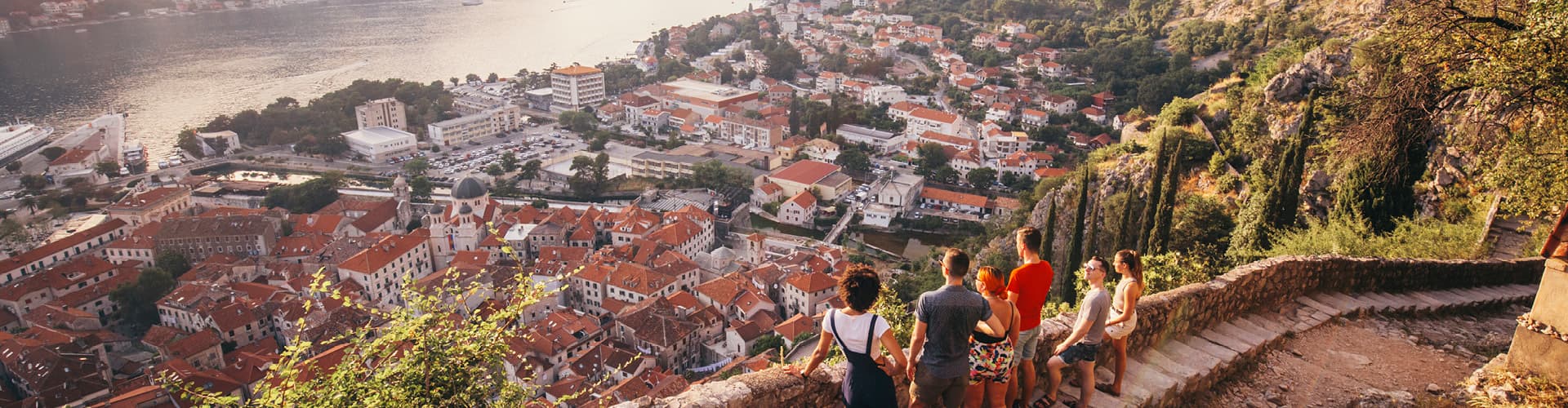
A glimpse of the destination you'll explore.

Scenic view of Whernside in Yorkshire Dales, lush green fields and stone walls under cloudy skies.
Peaceful clean river flowing near green farm fields and hills against cloudy sky
Beautiful landscape of Talisker Bay, Isle of Skye, Scotland with reflections and rolling hills.
View of the London Eye with vibrant autumn trees reflecting in a serene park lake.
Passenger ferry with flag of England moored on rippling water near coast against green hills covered with grass in nature

Upcoming departures

DatesPrice / personAvailability
6 Jun 202622 Jun 2026CAD 6,490Sold outBook my trip
Operated by UTracks

A TripFinder-trusted operator. We compare the trip and handle your booking with a real advisor — you travel under the operator's terms.

Book my trip →

More Europe adventures

Zagreb to Santorini: 35 Unforgettable Days image
G Adventures
Save 20%

Zagreb to Santorini: 35 Unforgettable Days

Bosnia and Herzegovina, Albania, Greece, Montenegro, Croatia · 35 days · Easy

fromCAD 7,679
Next: 21 Jun
Zagreb to Athens: Monasteries & The Mediterranean image
G Adventures
Save 20%

Zagreb to Athens: Monasteries & The Mediterranean

Bosnia and Herzegovina, Albania, Greece, Montenegro, Croatia · 29 days · Easy

fromCAD 5,839
Next: 21 Jun
Intrepid Travel Montenegro Kotor
Intrepid Travel
Deal

Vienna to Dubrovnik

Austria, Bosnia and Herzegovina, Croatia, Czechia, Hungary, Montenegro, Poland, Serbia, Slovakia · 29 days · Easy4.9(9)

fromCAD 6,923
Next: 27 Jun